
Pasakojimas ne apie buvusią kelionę, o turbūt apie planuojamas šios vasaros keliones, gal bus kam aktualu.
Pagal planą per Joninės turėjome pajudėti Lenkija-Slovakija-Vengrija-Rumunija-Bulgarija-Graikija(Chalkidikė)-Turkija(Stambulas)-Bulgarija(Pakrantė)-Rumunija(Pakrantė)-Moldavija-Ukraina-Lenkija.
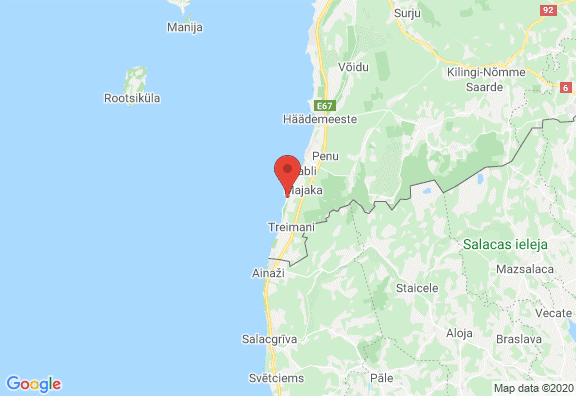
Kol susiklosčiusi situacija su COVID-19 ir visais karantinais neleidžia normaliai keliauti po užsienį, šiai vasarai puiki proga pasitrankyti po Baltijos šalis.
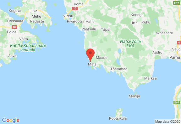
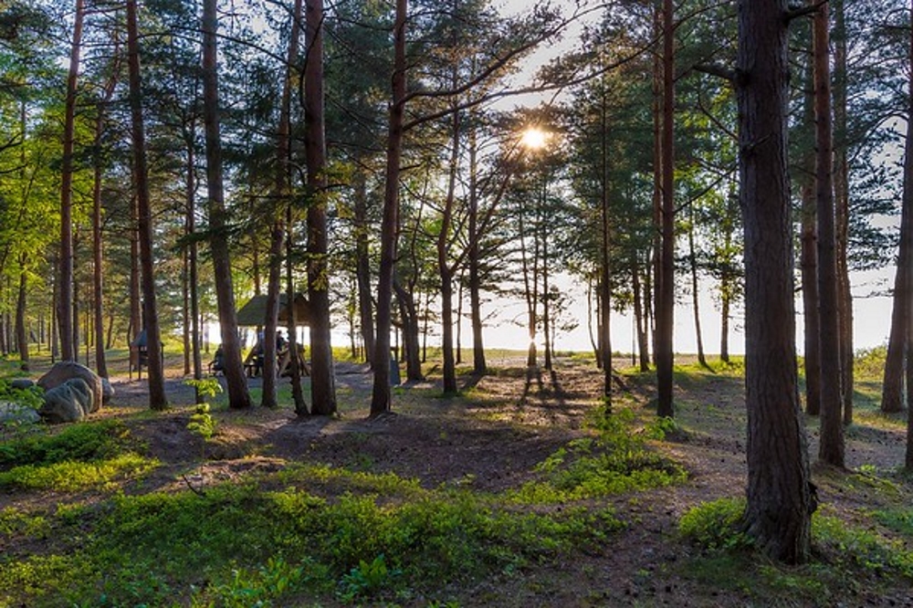
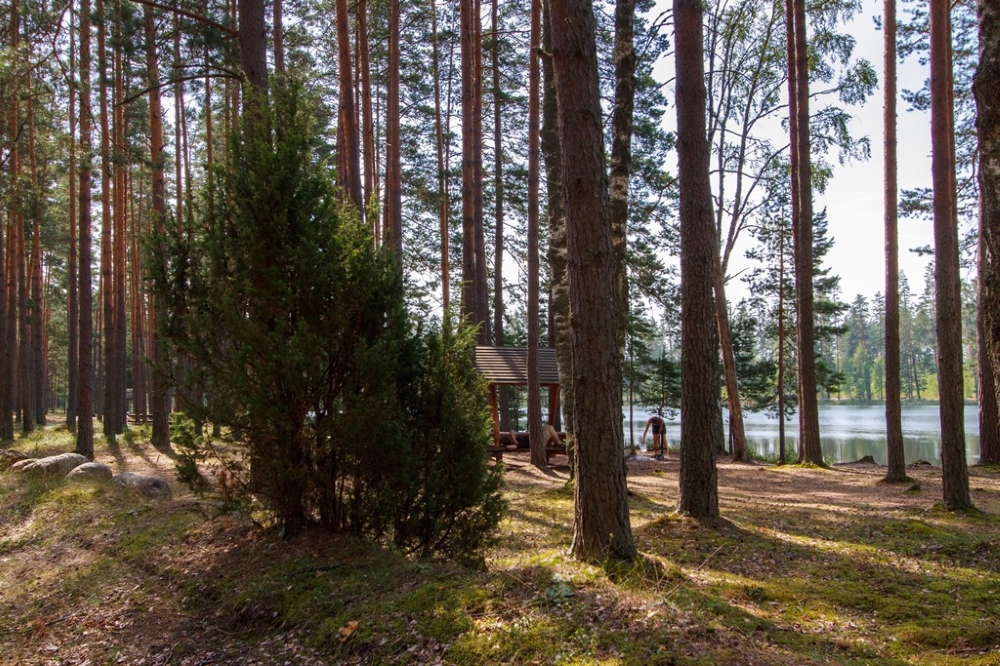
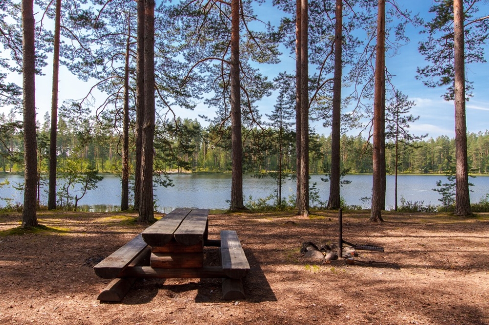
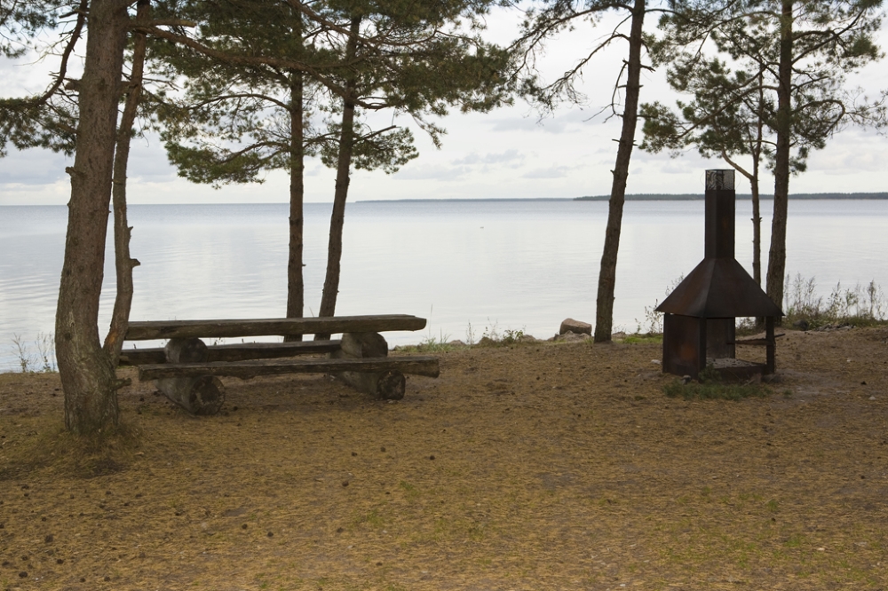
Atrinkau iš kelių šimtų Estijos stovyklaviečių, labiausiai man „prie dūšios”. Gal kam bus aktualu, vietos kuriose galima apsistoti su palapinėmis, keliaujant po mažosios Baltijos sesers miškus.
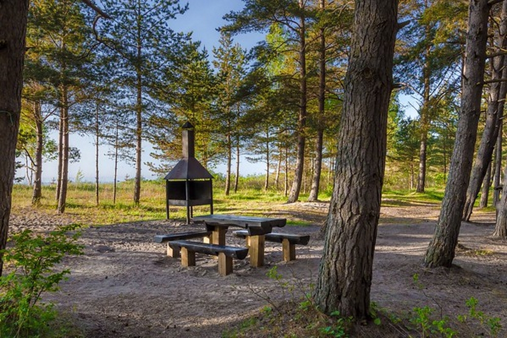
– Abula campsite
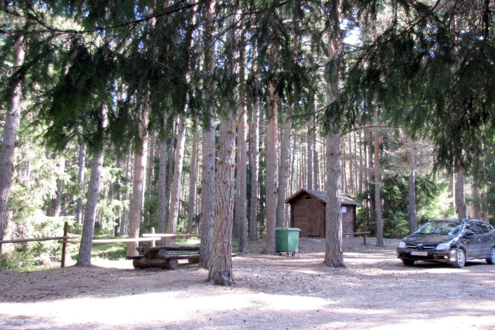
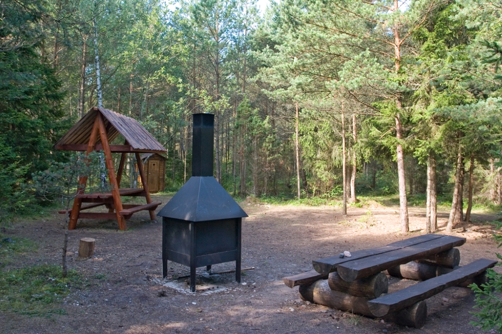
– Kirikumae campfiresite
– Krapi campsite
– Lake Rae campsite
– Leetse campsite
– Lemme campsite
– Matsiranna campsite
– Meremoisa campsite
– Paidra campfiresite
– Pangodi campsite
– Soela campsite
– Triigi campsite
– Tuhkana campsite
– Veere campsite
Visos stovyklavietės su mini aprašymu anglų kalba, koordinatėmis, žemėlapiu, bei keleta foto.
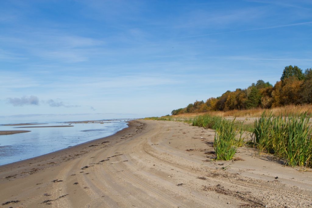
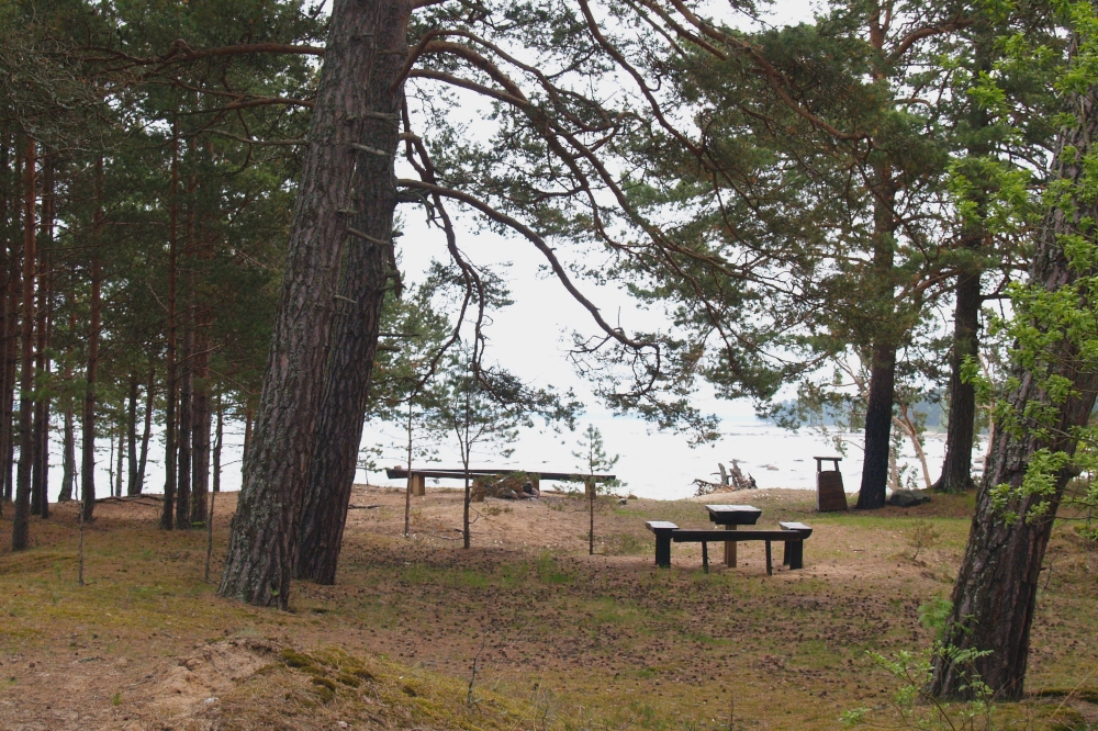
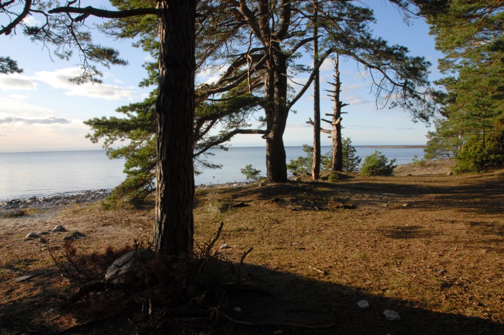
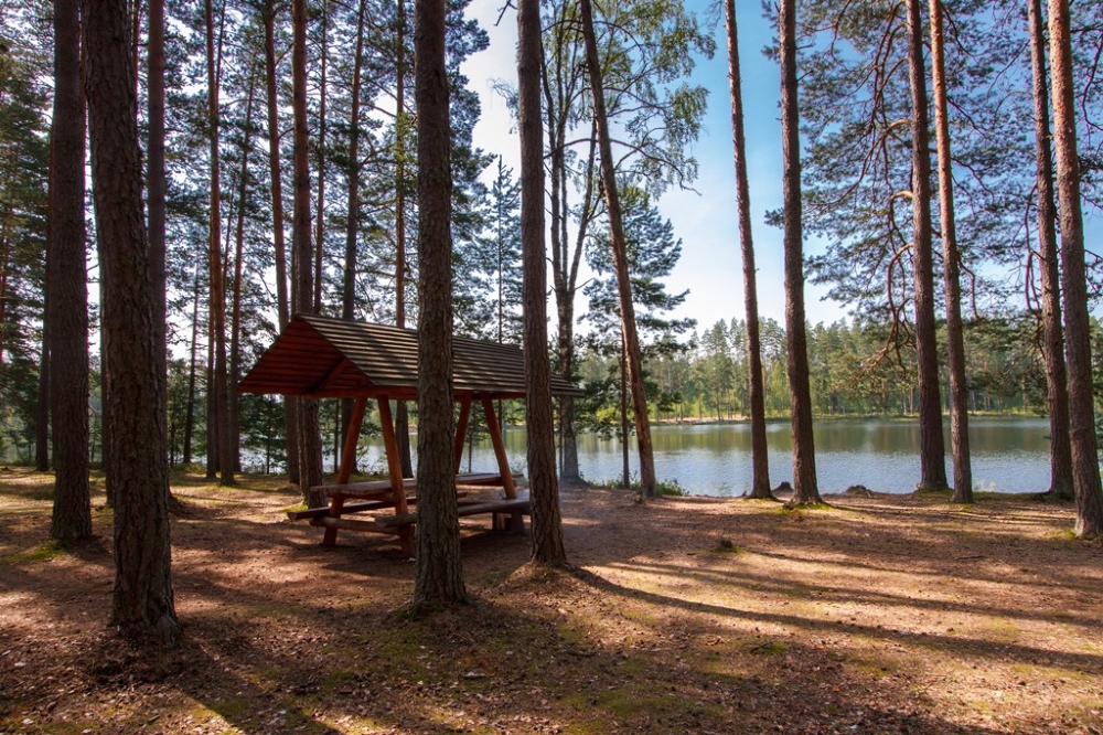
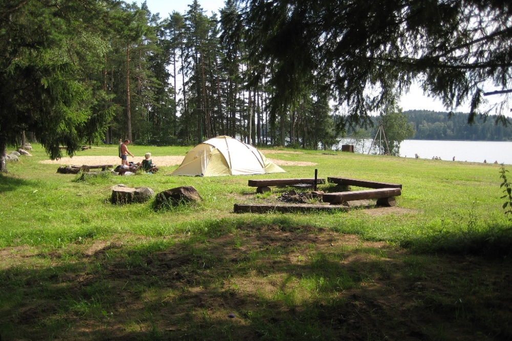
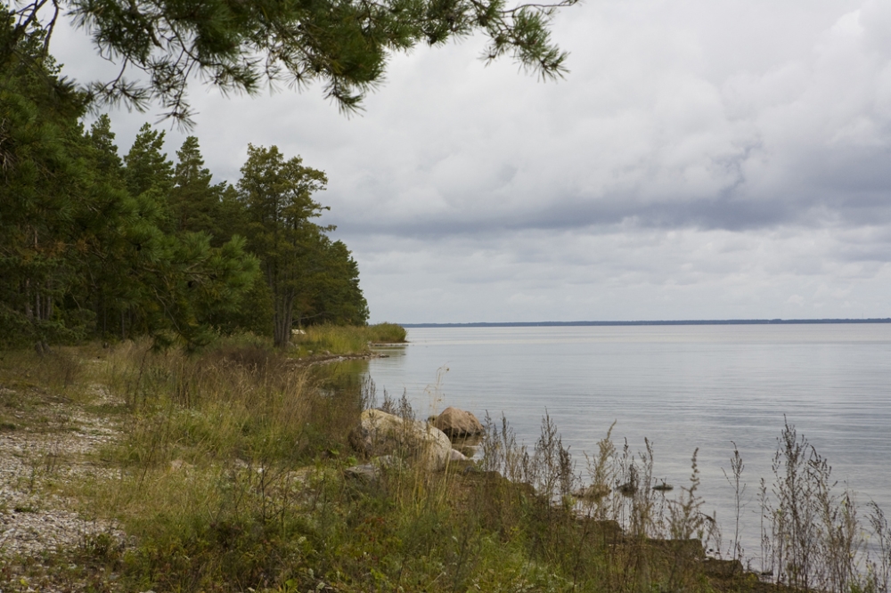
Abula campsite
Saaremaa, Saaremaa Recreation Area
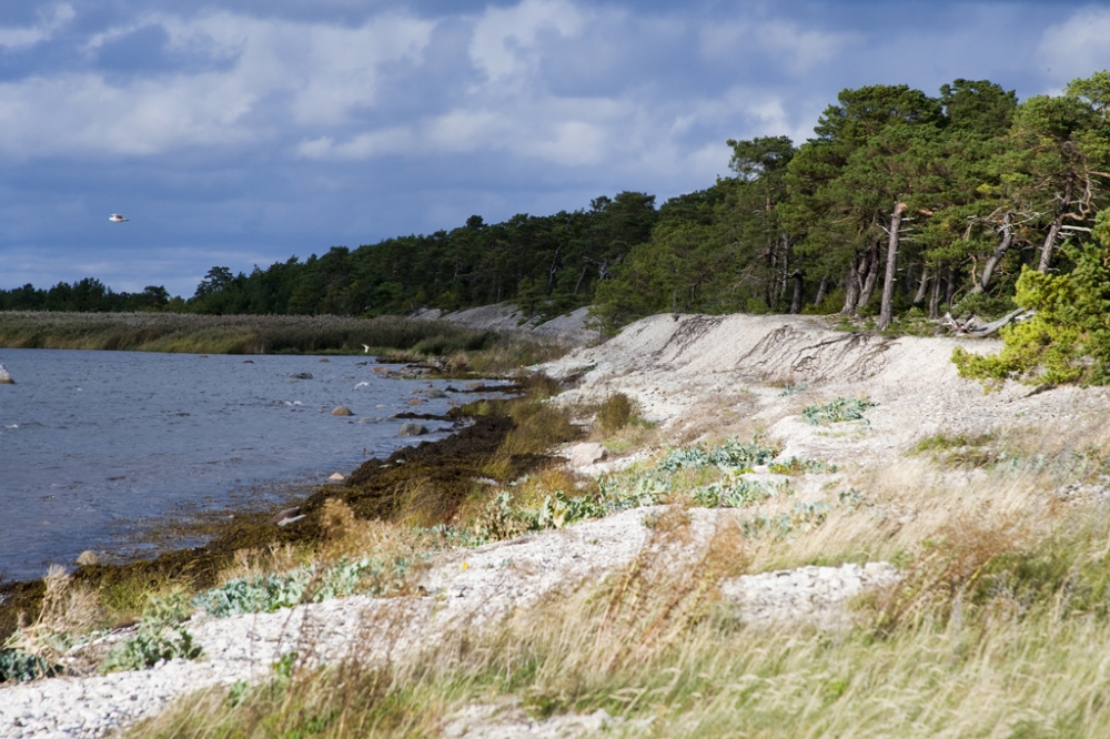
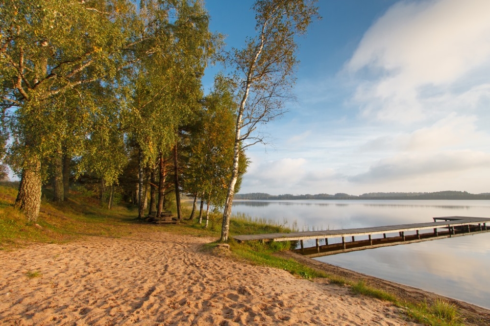
Pebbly drifts on the shore of Tagalaht bay, stunted coastal pines, the wind, the sun and a romantic atmosphere.
Phone
+372 454 6880
Type of object
Campsite
Parking facilities
Parking for 5 cars or 1 bus
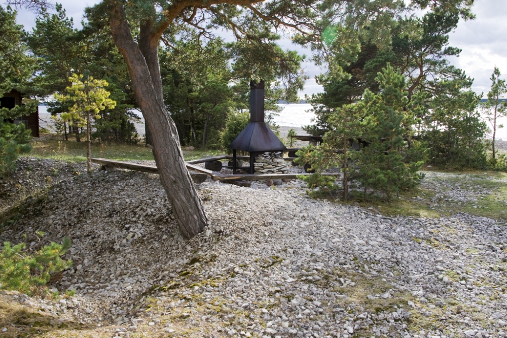
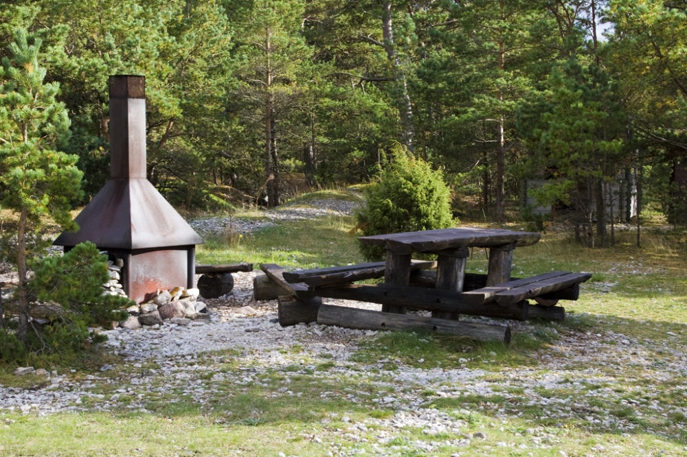
Amenities
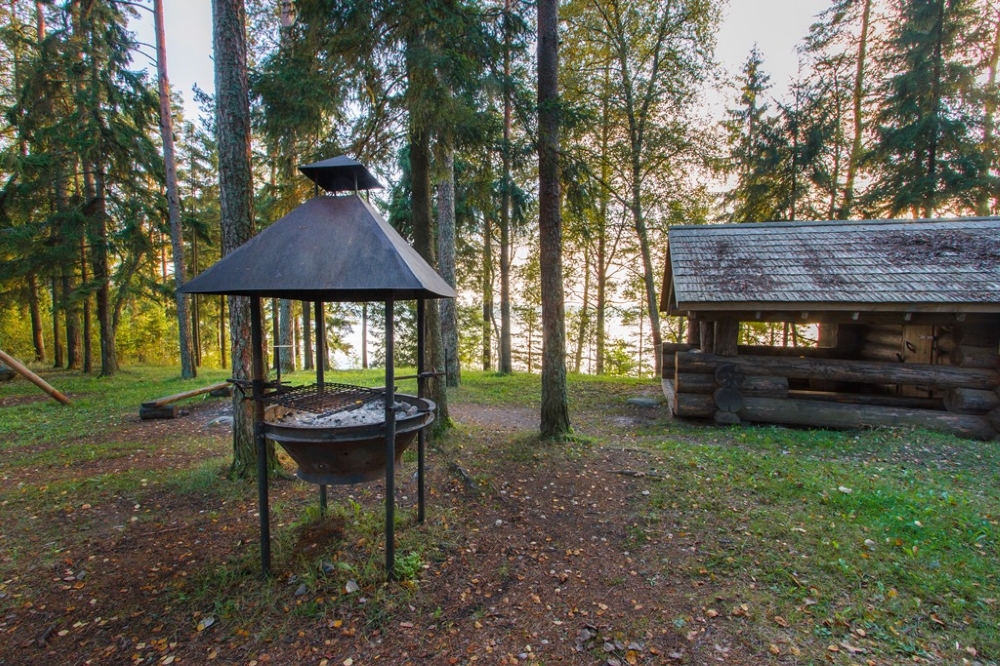
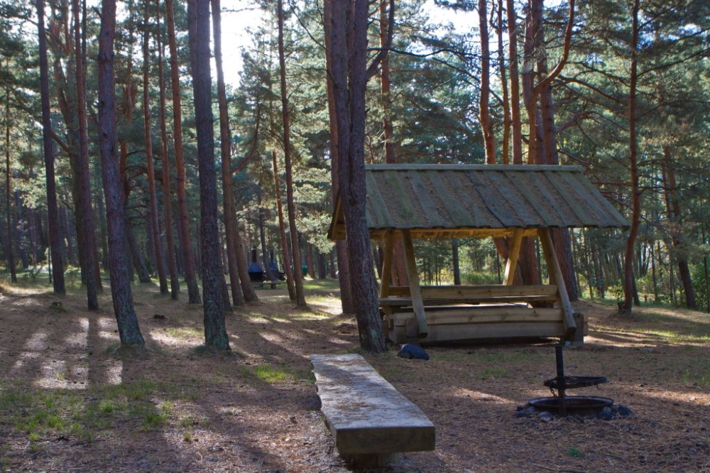
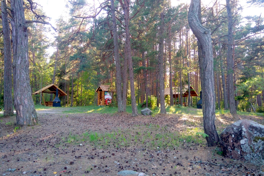
Tables and benches available, campfire sites, 2 dry toilets, woodsheds and information boards, shelters
Camping facilities
yes
Outdoor fireplace
yes
Campfire site
yes
Hiking options
Abula – Kalasma hiking trail
Additional information
Veere observation platform and Veere campfire sites near by
Before going on a nature walk please read the Environmental code of conduct (freedom to roam).
Restrictions
Campsite is located in Koorunõmme Nature Reserve. Information about restrictions can be obtained from the Environmental Board (+372 680 7438, [email protected])
Location
Kalasma and Abula villages, Saaremaa municipality
Object no 40 on recreation area map
Driving directions
Drive along Mustjala–Abula village road. 10.2 km from Mustjala the sign “RMK lõkkekoht” directs to the right.
Geographic coordinates
Long-Lat WGS 84
latitude: 58.451378
longitude: 22.114412
L-EST 97 x: 6480555 y: 389927
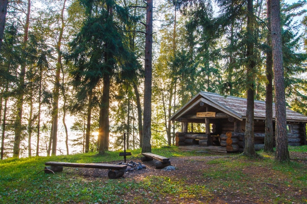
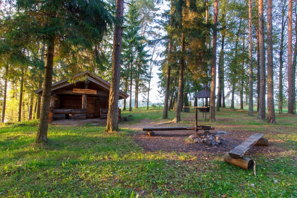
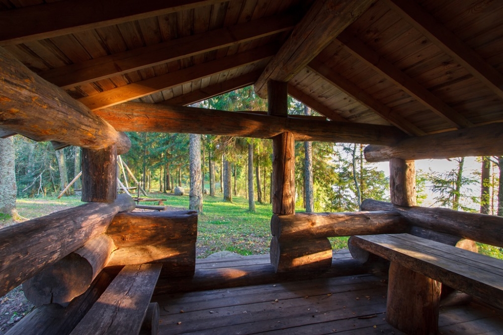
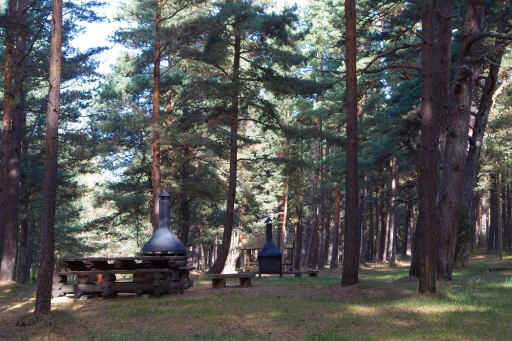
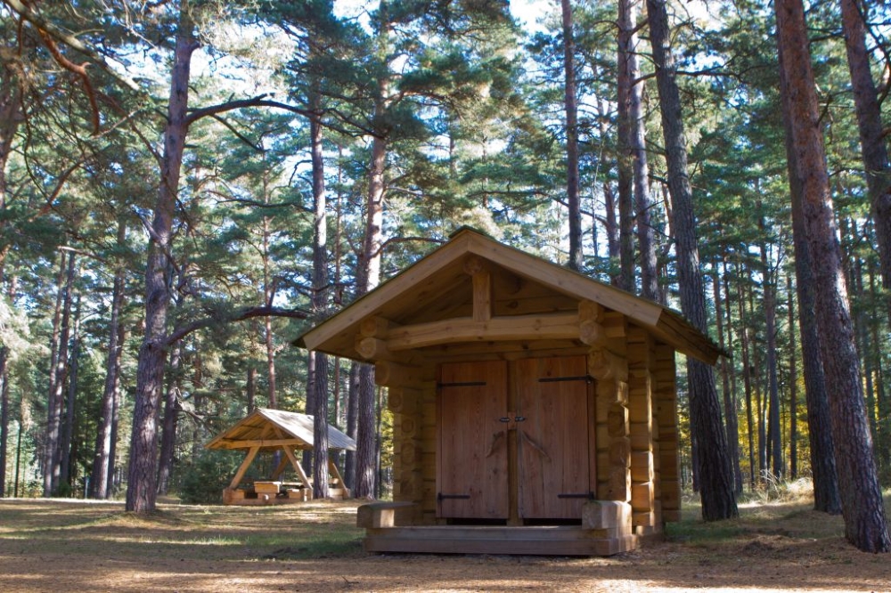
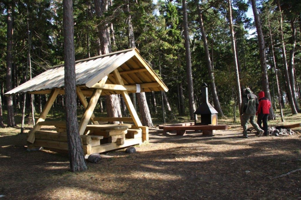
Kirikumäe campfire site
Võru County, Haanja-Karula Recreation Area
The campfire site at the picturesque Lake Kirikumäe is an excellent rest stop for hikers in the RMK Peraküla-Aegviidu-Ähijärve hiking route. In the forest hut, built of large logs from local forests, one can find shelter and accommodation.
Phone
+372 501 9564
Type of object
Campfire site
Parking facilities
Parking for 5 cars.
Amenities
1 fire ring with grills, 1outdoor fireplace benches, forest hut with bunks, dry toilet. The forest hut has no heating.
Camping facilities
The maximum number of tents (for 4) allowed is 2.
Outdoor fireplace
1outdoor fireplace
Campfire site
1 fire ring with grills
Water
Water is available from Lake Kirikumäe.
Hiking options
The campfire site is at the 3.2 km Kirikumäe hiking trail and on the RMK Peraküla-Aegviidu-Ähijärve Hiking Route.
Accommodation
yes
Sleeps (no. of people)
Hut for 4 people.
Sights
Lake Kirikumäe, forest and meadow communities
Winter accessibility
No snow removal from the path to the campfire site; firewood provided.
Additional information
Before going on a nature walk please read the Environmental code of conduct (freedom to roam).
Restrictions
The campfire site is located in Kirikumäe Landscape Protection Area, information about restrictions can be obtained from the Environmental Board (+372 680 7438, [email protected]).
Location
Võru municipality, Võru County. Object no 38 on the recreation area map.
Driving directions
Drive about 19 km on Võru–Luhamaa road (Road no. 2, E263) towards Vastseliina and turn right to Vastseliina. Drive past the fire station, across the bridge, to the junction, turn left and drive 6.8 km straight ahead on the asphalt road up to the intersection at the Järvsaare bus stop. Turn left and drive 500 m. The lake and campfire sites, as well as the start of the trail are to the right of the road.
Geographic coordinates
Long-Lat WGS 84
latitude: 57.685522
longitude: 27.254861
L-EST 97 x: 6398424 y: 694105
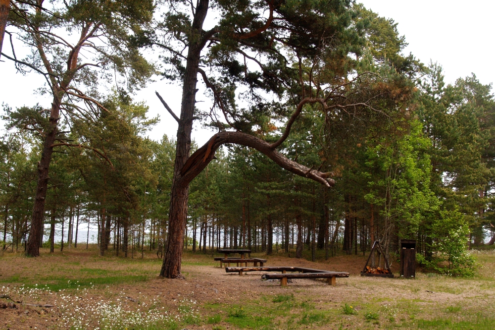
Krapi campsite
Pärnu County, Pärnumaa Recreation Area
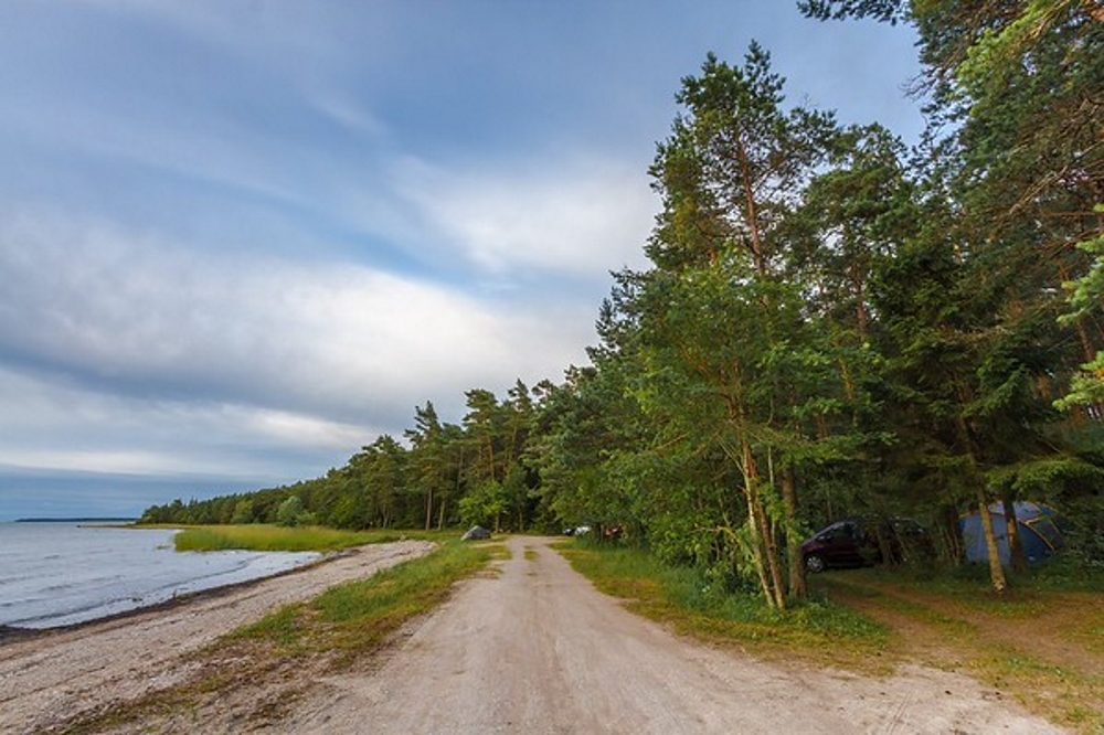
The campsite is situated in the shade of old coastal pines on the ca 1,5 km stretch of the seashore.
Phone
+372 505 8242
Type of object
Campsite
Parking facilities
Parking area for 30 cars or 5 tour buses, also next to tents on the campsite.
Amenities
Camping, fire rings, picnic shelters, information boards, large asphalt parking area, 3 parking spaces, outdoor toilets, freshwater wells and waste bins.
Camping facilities
yes
Outdoor fireplace
yes
Campfire site
48 fire places
Hiking options
On the RMK Hiking Route Kopra – Ikla
Sights
A stunning view of the Gulf of Riga, sandy beach, camping under old coastal pines, a chance to have a beach holiday and enjoy picturesque sunsets.
Berries and mushrooms
Bilberries, mushrooms
Additional information
Firewood not available at the campsite’s fire rings. Firewood and barbecue coals can be bought in the local shop (1 km away) and at Lemme campsite (3 km away).
Restrictions
Off-road vehicle (ATV) traffic is prohibited!

Location
Häädemeeste municipality, Pärnu County. Object no 1 on the recreation area map.
Driving directions
Drive on old Pärnu–Ikla road 18 km to south from Häädemeeste, follow the sign pointing towards the sea. Entry to the campsite from the parking area.
Geographic coordinates
Long-Lat WGS 84
latitude: 57.938893
longitude: 24.390877
L-EST 97 x: 6421999 y: 523154

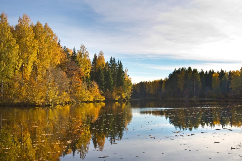
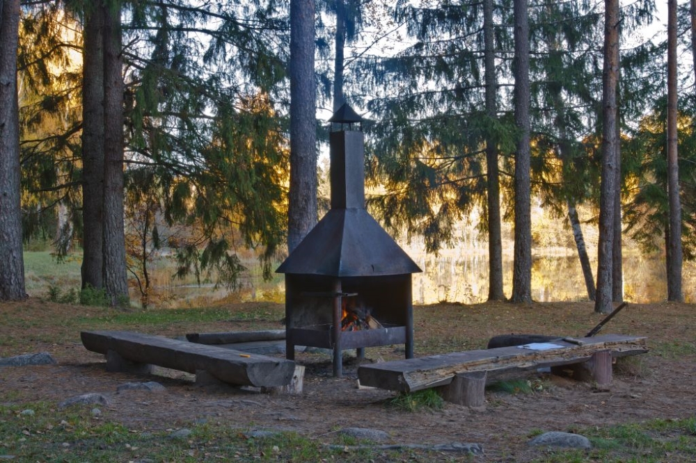
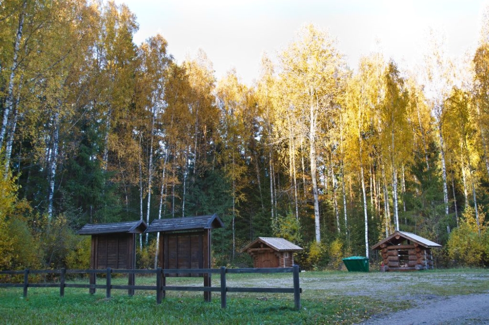
Lake Rae campsite
Pärnu County, Pärnumaa Recreation Area
The campsite is situated at Lake Rae and is a nice place for a forest recreation, swimming, fishing or hiking on Lake Rae hiking trail. The Kopra –Ikla section (74 km) of RMK Hiking Route passes the campsite.
Phone
+372 505 8242
Type of object
Campsite
Parking facilities
Parking area for 15 cars.
Amenities
Wooden pier, campfire sites, picnic shelters, firewood shed, outdoor toilets and freshwater well, children’s playground.
Camping facilities
yes
Outdoor fireplace
yes
Water
Water can be taken from the well.
Hiking options
Hiking on the Lake Rae hiking trail and on the Kopra – Ikla section (74 km) of RMK Hiking Route.
Sights
Versatile nature, a chance to observe the activities of wild animals and birds or hike along the Lake Rae hiking trail which starts at the campsite. A fish ladder has been built on the river dam.
Berries and mushrooms
Bilberries, cowberries, mushrooms
Winter accessibility
Firewood provided; access by car to the parking area of the campsite.
Additional information
Before going on a nature walk please read the Environmental code of conduct (freedom to roam).
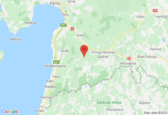
Location
On the shore of Lake Rae, Saarde municipality, Pärnu County. Drive 8 km on Häädemeeste–Tõitoja road and follow the sign to Lake Rae. Object no 14 on the recreation area map.
Driving directions
Drive 8 km on Tõitoja–Häädemeeste road, turn left at the sign to Lake Rae campsite and hiking trail. Follow the signs to the campsite.
Geographic coordinates
Long-Lat WGS 84
latitude: 58.121375
longitude: 24.769256
L-EST 97 x: 6442513.3 y: 545332.3

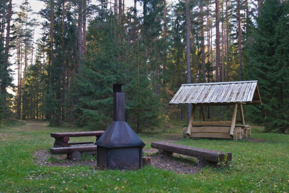

Leetse campsite
Harju County, Surroundings of Tallinn Recreation Area
Access to the 2nd campfire site in the camping area is closed because a dangerous tree has fallen over the road.
Leetse campfire sites are at the beautiful Lahepere Bay in the pine forest. There are 5 campfire sites, located far enough from each other for some privacy.
Phone
+372 676 7842
Type of object
Campsite
Parking facilities
4 parking spaces for 3-4 cars
Amenities
5 fire rings, picnic tables, firewood shelters, information board with general information, dry toilet, parking space
Camping facilities
yes
Outdoor fireplace
yes
Hiking options
yes
Sights
Sea and beach, Leetse Cliff, Leetse Manor. NB! The manor is a private property and access to the manor territory is permitted with the owner’s consent only.
Additional information
Access road is kept clear of snow up to Leetse Manor, 1 km section of road to the campfire site is not cleared of snow, no firewood.
Before going on a nature walk please read the Environmental code of conduct (freedom to roam).
Location
Paldiski, Pakri peninsula, Lääne-Harju municipality, Harju County
Object no 11 on recreation area map
Driving directions
Drive from Tallinn towards Paldiski. After arriving at the border of the city, turn right at the large junction towards Leetse and drive 4 km to Leetse Manor. Turn left there and drive 1.2 km along the seaside road up to the information board and a path heads to the right from there towards the sea to the campfire site.
Geographic coordinates
Long-Lat WGS 84
latitude: 59.372503
longitude: 24.120422
L-EST 97 x: 506846.4 y: 6581617


Lemme campsite
Pärnu County, Pärnumaa Recreation Area
Lemme campsite has been a popular holiday destination among domestic and foreign tourists for dozens of years. The campsite is situated on the seashore in the shade of pine trees and is surrounded by fence.
Phone
+372 505 8242
Type of object
Campsite
Parking facilities
Parking for 30 cars.
Amenities
Information board, campfire sites, picnic tables with shelters, service house, outdoor stage, freshwater well, outdoor toilets, wheelchair ramp. In the service house there are pay toilets, shop and café, showers and sauna.
Camping facilities
yes
Outdoor fireplace
yes
Campfire site
yes
Wheelchair accessibility
true
Hiking options
The RMK Hiking Route section Kopra–Ikla (74 km) passes the campsite.
Sights
The campsite is situated in the coastal pine forest. You can enjoy a spectacular view of the Gulf of Riga and evening sunsets, or sunbathe on the sandy beach, swim or watch sea birds.
Berries and mushrooms
Bilberries, mushrooms
Additional information
Pitching a tent is free of charge, each motorised vehicle entry to the campsite is 4.00 €. Possible to organise events for up to 500 participants. Krapi campsite is situated 3 km to the south along the shoreline. Firewood not available at the campsite’s fire rings. Firewood and barbecue coals can be bought at the gate and in the local shop. Before going on a nature walk please read the Environmental code of conduct (freedom to roam).
Location
Häädemeeste municipality, Pärnu County. If you drive along Häädemeeste–Ikla road, follow the sign to Lemme campsite 200 m south from the Lemme bus stop. Object no 2 on the recreation area map.
Driving directions
Drive on the old Pärnu–Ikla road 18 km towards Treimani village. Pass the Lemme bus stop and follow the sign to Lemme campsite.
Geographic coordinates
Long-Lat WGS 84
latitude: 57.964971
longitude: 24.405433
L-EST 97 x: 6424905 y: 523997

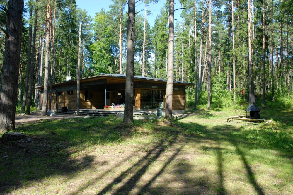
Matsiranna campsite
Pärnu County, Pärnumaa Recreation Area
The seaside campsite is an attractive place for swimming and camping in the summer months.
Phone
+372 505 8242
Type of object
Campsite
Parking facilities
Parking for 30 cars.
Amenities
Parking spaces, picnic tables with shelters, outdoor fireplaces with barbecue grill, dry toilet. Firewood not available at the campsite’s fire rings.
Camping facilities
yes
Outdoor fireplace
yes
Sights
The campsite is situated on the seashore, under pine trees. A spectacular view of the sea, sunsets in the evening, sunbathing and swimming.
Berries and mushrooms
Bilberries, mushrooms
Additional information
Before going on a nature walk please read the Environmental code of conduct (freedom to roam).
Location
Lääneranna municipality, Pärnu County. Object no 24 on the recreation area map.
Driving directions
Drive towards Varbla on Tõstamaa–Valta road. Turn left before the Kulli urban community and drive 5 km to the Matsiranna beach.
Geographic coordinates
Long-Lat WGS 84
latitude: 58.370370
longitude: 23.738224
L-EST 97 x: 6470016 y: 484682

Meremõisa campsite
Harju County, Surroundings of Tallinn Recreation Area
Parking outside marked parking areas is strictly forbidden! No firewood available in winter!
The campsite is at the seaside, by Lohusalu bay. There are 7 campfire rings in the area, scattered along the seafront. At each campfire site there is a table and benches, a waste bin and a shelter for firewood. There are also dry toilets near the campfire sites. There are 3 maps on the campsite, showing the locations of all the campfire sites and dry toilets. The maps are at the entrance roads to the campsite.
Phone
+372 676 7842
Type of object
Campsite
Parking facilities
Parking areas of different size, parking space for 60 cars
Amenities
3-part information board with general information, 2 information boards with campsite maps, 7 campfire sites, incl. 3 outdoor fireplaces, 5 dry toilets, campsite for 50 tents, stone fence around parking area
Camping facilities
yes
Outdoor fireplace
yes
Campfire site
yes
Wheelchair accessibility
yes
Sights
Sandy beach, coastal pine forests of varying stand ages
Winter accessibility
Access road to the campsite and roads in the campsite are kept clear of snow; no firewood available.
Additional information
Before going on a nature walk please read the Environmental code of conduct (freedom to roam).
Location
Lääne-Harju municipality, Harju County
Object no 1 on recreation area map
Driving directions
Drive from Tallinn towards Lohusalu and go through Keila-Joa. 300 m after the Meremõisa bus stop follow the sign to the right to Meremõisa campsite.
Geographic coordinates
Long-Lat WGS 84
latitude: 59.399123
longitude: 24.251123
L-EST 97 x: 6584603 y: 514266
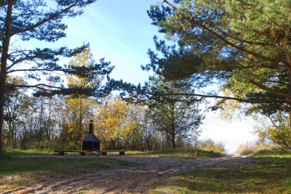
Paidra campfire site
Võru County, Räpina–Värska Recreation Area
Paidra campfre site is situated at Lake Paidra. A nice place for relaxation in the pine forest.
Phone
+372 676 7122
Type of object
Campfire site
Parking facilities
Parking area for 13 cars.
Amenities
1 fire ring with barbecue grill, 3 outdoor fireplaces, woodshed with a sleeping loft, 1 dry toilet, 2 parking area.
Camping facilities
The maximum number of tents (for 4) allowed is 20.
Outdoor fireplace
3 outdoor fireplaces
Campfire site
1 fire ring with barbecue grill
Water
Water can be taken from the lake.
Hiking options
The campfire site is on the RMK Peraküla-Aegviidu-Ähijärve Hiking Route.
Accommodation
yes
Sleeps (no. of people)
In the woodshed 3 people.
Berries and mushrooms
Bilberries, cowberries, mushrooms
Winter accessibility
Accessible around the year.
Additional information
Before going on a nature walk please read the Environmental code of conduct (freedom to roam).
Location
Võru municipality, Võru County. Object no 13 on the recreation area map.
Driving directions
Drive on Räpina–Võru road to Paidra, if coming from Räpina, turn left at the sign “Paidra lõkkekoht”. The campfire site is about 400 from the sign.
Geographic coordinates
Long-Lat WGS 84
latitude: 57.913515
longitude: 27.189276
L-EST 97 x: 6423596 y: 688978


Pangodi campsite
Tartu County, Tartu–Jõgeva Recreation Area
A popular summer camping ground in a good location with good swimming opportunities. It is situated close to the main road, separated with a forest patch.
Phone
+372 676 7122
Type of object
Campsite
Parking facilities
Parking for 30 cars in the parking area of the campsite and at roadside.
Amenities
Parking area, information board, 3 outdoor fireplaces, picnic table with shelter, 3 fire rings with barbecue grill, 18 benches, woodshed, dry 2-seater toilet, changing cabins, municipal recreation facilities, volleyball court
Camping facilities
The maximum number of tents (for 4) allowed is 30.
Outdoor fireplace
3 outdoor fireplaces.
Wheelchair accessibility
It is possible to move in the wheelchair in the campsite, no special facilities.
Hiking options
The Pikksaare hiking trail (1km) passes Pangodi campsite.
Sights
Lake Pangodi and forest park.
Additional information
Before going on a nature walk please read the Environmental code of conduct (freedom to roam). It is a good idea to bring your own barbecue charcoal and firewood, because not all hikers follow the principles of sustainable consumption or are considerate of the other hikers.
Restrictions
The campsite is situated in Pangodi Landscape Reserve. Waterways of the protected area are restricted to non-motorised boating. Camping and making campfire is allowed in designated places only. Planning public events with more than 50 participants and using motorised vehicles on the waters of the protected area requires prior consent from the protected area manager (the Environmental Board +372 680 7438; [email protected]). Cycling and use of motorised vehicles outside roads and paths. Parking motorised vehicles outside designated parking areas is prohibited.
Location
Kambja municipality, Tartu County. Object no 46 on the recreation area map.
Driving directions
Drive 13 km from Tartu towards Võru, turn right towards Otepää and drive 9 km until you see Lake Pangodi on your left. Leave the car to the parking area, the campsite is reachable only on foot (500 m), follow the signs, please
Geographic coordinates
Long-Lat WGS 84
latitude: 58.199632
longitude: 26.571254
L-EST 97 x: 6453867 y: 651156


Soela campsite
Saaremaa, Saaremaa Recreation Area
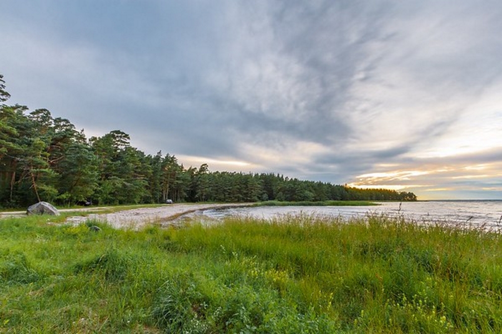
Campsite by the seaside with a beautiful sandy beach
Phone
+372 454 6880
Type of object
Campsite
Parking facilities
Parking for 5 cars or 1 bus
Amenities
3 campfire sites, 1 sheltered picnic table, 2 regular picnic table, 2 firewood sheds and 2 outdoor toilets
Camping facilities
yes
Outdoor fireplace
yes
Campfire site
yes
Sights
Sandy beach
Additional information
Before going on a nature walk please read the Environmental code of conduct (freedom to roam).
Location
Saaremaa municipality
Object no 42 on recreation area map
Driving directions
Starting from Kuressaare:
Drive to Leisi. Drive through Leisi along Leisi–Soela road. The campsite is located on the 1 km of the road. (follow the sign “RMK lõkkekoht”).
Geographic coordinates
Long-Lat WGS 84
latitude: 58.598465
longitude: 22.607676
L-EST 97 x: 6496231 y: 419057


Triigi campsite
Saaremaa, Saaremaa Recreation Area
A seaside campsite near the Port of Triigi, where ferries travel to Hiiumaa.
On the beautiful sandy beach on the Triigi peninsula.
Phone
+372 454 6880
Type of object
Campsite
Parking facilities
Parking for 5 cars
Amenities
3 campfire sites, 1 sheltered picnic table, 2 regular picnic tables, information board, dry toilet
Camping facilities
yes
Outdoor fireplace
yes
Sights
Karja Church, Angla windmills, Sassi dinner house
Additional information
Before going on a nature walk please read the Environmental code of conduct (freedom to roam).
Location
Saaremaa municipality
Object no 45 on recreation area map
Driving directions
Starting from Kuressaare:
Drive to Leisi. From Leisi drive 2 km along Leisi–Triigi road and turn by the sign „Leisi sadam” (Leisi harbour). Follow the sign “RMK lõkkekoht”.
Geographic coordinates
Long-Lat WGS 84
latitude: 58.596946
longitude: 22.694327
L-EST 97 x: 6495960 y: 424091
Tuhkana campsite
Saaremaa, Saaremaa Recreation Area
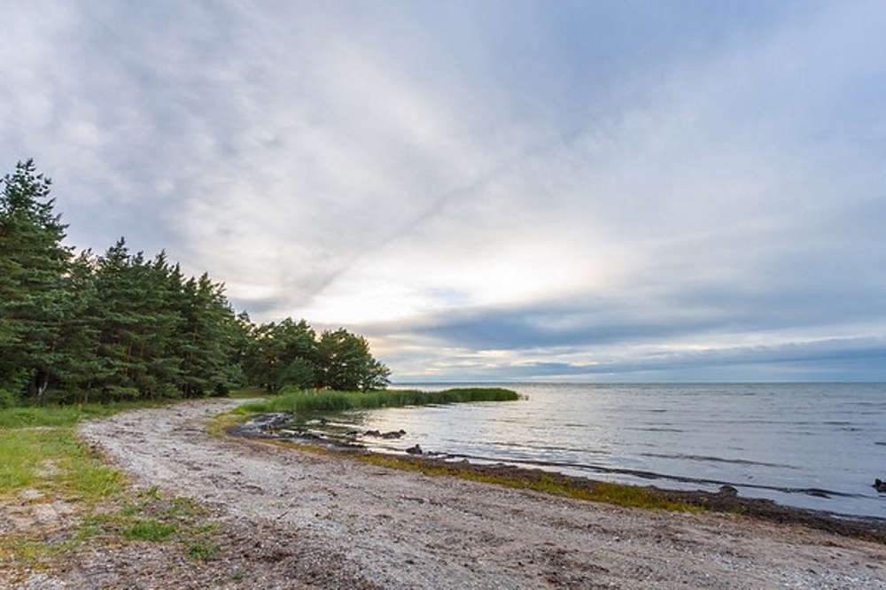
Very beautiful beach with white sand, suitable for swimming. The beach is about 600 m walk from the parking area. The boardwalk leads to the dunes where you can enjoy a beautiful view to the seaside.
Near the campsite there is a volleyball court. The surrounding forests are good for picking berries and mushrooms.
Phone
+372 454 6880
Type of object
Campsite
Parking facilities
Parking for 10 cars or 2 buses
Amenities
Information board, boardwalk leading to the campiste, 2 outdoor fireplaces, 2 sheltered picnic tables, 2 dry toilets, firewood shed
Camping facilities
yes
Outdoor fireplace
yes
Sights
The best sandy swimming beach in Saaremaa. 500 m to the beach, access only along the boardwalk. Good mushroom and wild berry forests around.
Additional information
Before going on a nature walk please read the Environmental code of conduct (freedom to roam).
Location
Pammana peninsula, Saaremaa municipality
Object no 41 on recreation area map
Driving directions
To get to Tuhkana campsite, drive 2 km along Metsküla–Soela–Leisi road. From the sign “RMK Tuhkana puhkekoht” drive about 450 m to the parking area.
Geographic coordinates
Long-Lat WGS 84
latitude: 58.591935
longitude: 22.506831
L-EST 97 x: 6495630 y: 413179

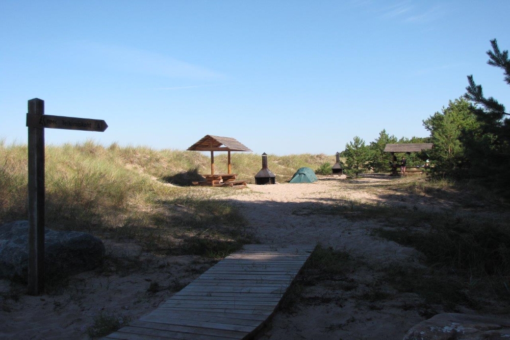
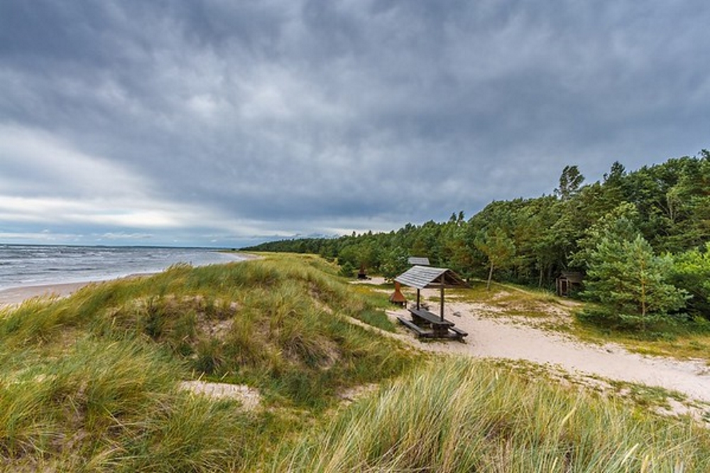
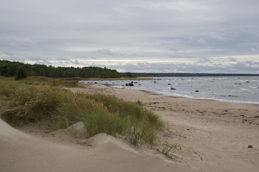
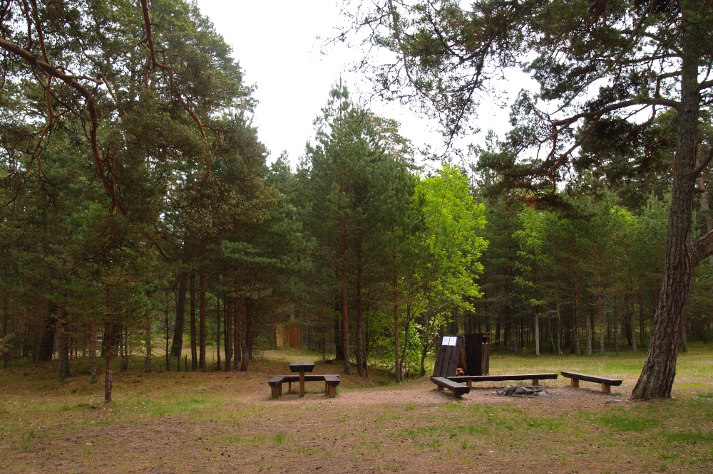
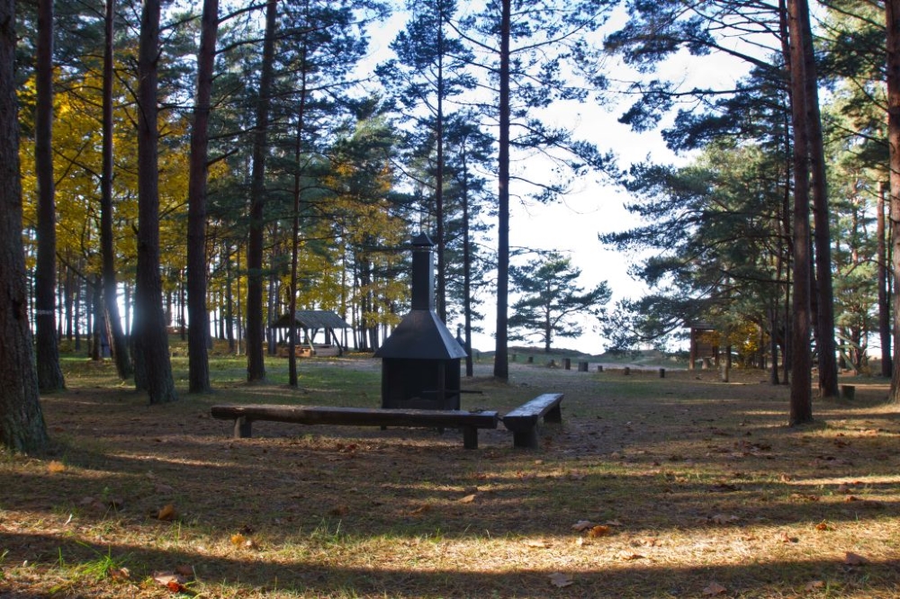
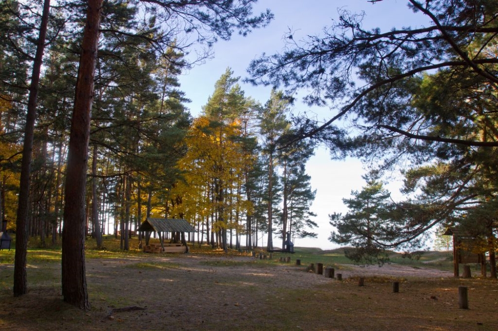
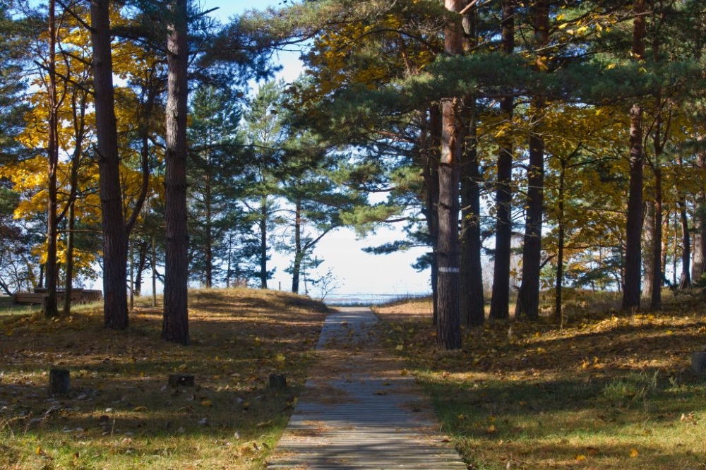
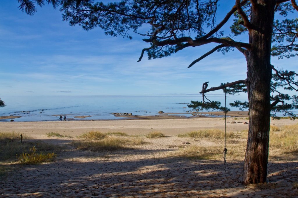
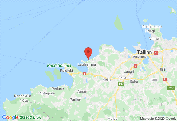
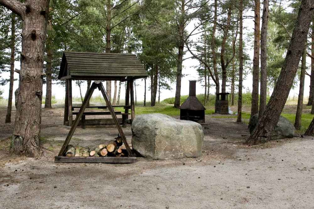
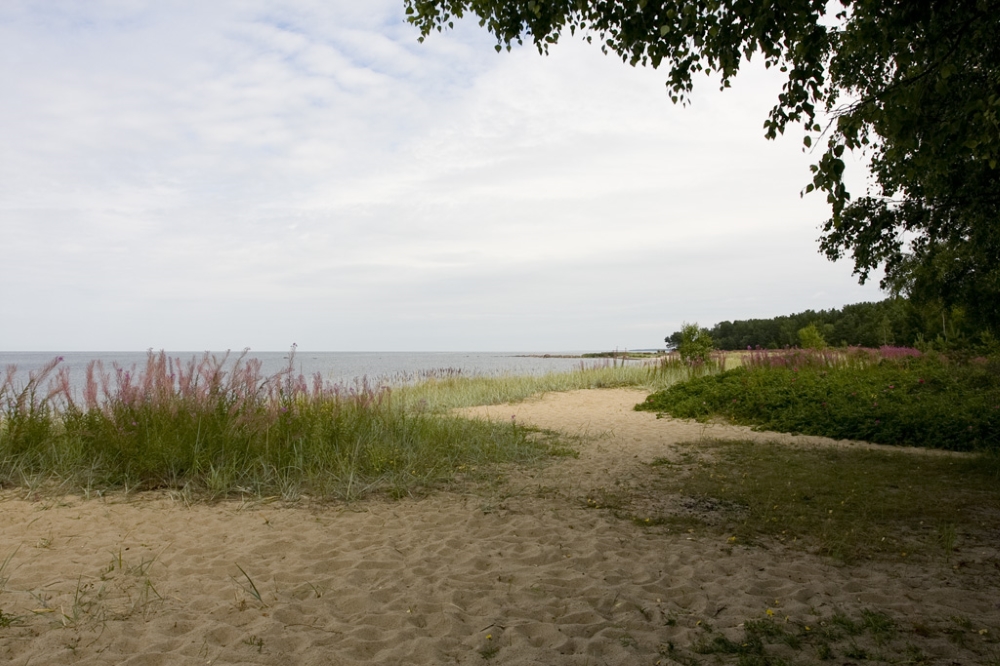
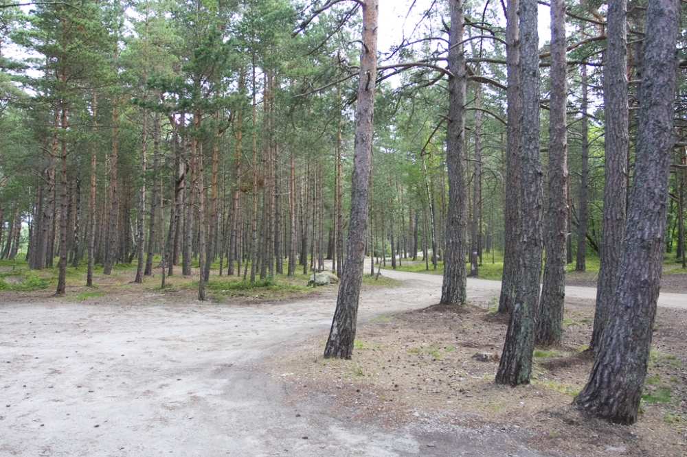
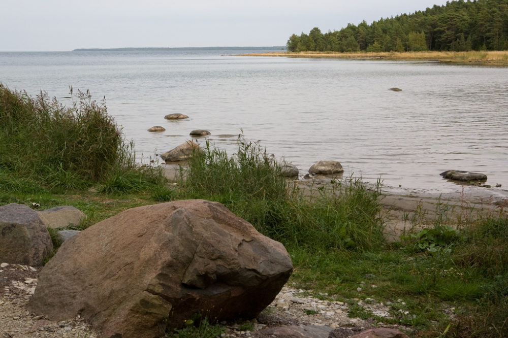
Veere campsite
Saaremaa, Saaremaa Recreation Area
A lengthy seaside campsite on Tagamõisa peninsula on the shore of the Tagalaht bay. Beautiful sea views. Good camping sites in the pine forest right on the pebbly beach.
Marked trails to seaside starting from 5th km along Pidula-Veere road.
Phone
+372 454 6880
Type of object
Campsite
Parking facilities
Parking for 2 cars
Amenities
5 campfire sites, picnic tables, information boards, dry toilets, woodsheds
Camping facilities
yes
Outdoor fireplace
yes
Campfire site
yes
Sights
Nice beach
Restrictions
The campsite is situated in the Teesu Nature Reserve. Before your visit, please refer to the protection rules of Teesu Nature Reserve.
Information about restrictions can be obtained from the Environmental Board (+372 680 7438, [email protected]).
Location
Veere village, Saaremaa municipality
Object no 30 on recreation area map
Driving directions
To get to the Veere campfire sites, drive 4 km along Pidula–Veere road (there are three signs “RMK lõkkekoht”).
Geographic coordinates
Long-Lat WGS 84
latitude: 58.422671
longitude: 22.073952
L-EST 97 x: 6477427 y: 387474


Labai patiko. Užjaučiu dėl mašinos gedimo. Atrodo nelabai svarbi ir net paprasta dalis, bet kiek nervų kainuoja ir iškreipia kelionę. Net ir tokiomis sąlygomis daug pamatėte. Garsusi Transfagarešanas net 2 kartus įveiktas, pirmas iš bėdos. Jūsų pusę objektų esu matęs ir jie užkabino, kad norėčiau ir kitus pamatyti, po 7 miestų Transilvaniją pasimalti.
Turbūt tai pagrindinė priežastis, kodėl aš dar neaplankiau Rumunijos, nors seniai planuoju – nenoriu ten su savo mašina. Pirmiausiai tai gaila beveik keturių kelionėj prarastų atostogų dienų, o ir tokie nemalonumai svetimoj šaly greit nesisprendžia. Kadangi keliai ten tikrai prasti, tai tikimybė, kad kažkas gali sulūžti gana didelė, o ir naujos ir patikimos mašinos neturiu tokiom kelionėm. Ir dar dėl to, kad nebuvo ta kryptimi tiesioginių skrydžių – dėlioji, dėlioji tuos persėdamus skrydžius ir spjovęs nusiperki ten, kur yra tiesioginis, nors neseniai atsiradęs į Bulgariją, priminė senus norus.
Pirmas gedimas neturėjo nieko bendri nei su šalim, nei su keliais, o del padangos, ir Lietuvoj galima taip į duobę pakliūt
po to kai Lenkija smarkiai padirbėjo su keliais , kažkaip tos automobilinės kelionės visai nebaisios. yra daug ir privalumų, prisikrauni ką nori , kiek nori, 4 žmonėm į Balkanų kraštus ar tą pačią Rumuniją (ji vis dar laukia mūsų) finansinių alternatyvų turbūt nelabai.
Aišku gaila, kad nepamatėte to, ką planavote, bet svarbiausiu keliu pravažiavote.
Užuojauta dėl prarasto laiko. Pro Rumuniją važiavau vieną kartą, per kalnus su visais žmoniu prijaukintais gyviais pakeliui, diedais, ganančiais vieną karvę, obuolius pardavinėjančiom bobom (ne blogaja prasme, aš feministas 🙂 ) prie kelio ir padangų remonto dirbtuvėm tik pasibaigus dar turbūt romėnų grįstiems kalnų keliams – 30 km/h vidutiniu greičiu. Važiuočiau dar, nes čia jums be Vokietija su savo autobanais. Čia – švogerių kraštas 🙂
Ačiū už pasakojimą!
Velnias. Galvojau cia Rumunija pasimirso 🙂 aciu uz pasakojima.
Jau suplanuotos pirmos 5 dienos i Rumunija ir pas mane. Dar liko savaite, bet itariu tai bus pietu karpatuose.
Aciu
Ar buvo vieta, kur sirdis lieptu pasilikt ilgiau nei 1 dienai?
Man labiausiai isimine kalnai, ten galeciau dar pabut, pasivaiksciot.
Labai geras pasakojimas, tik aš pasigedau pagrindinio objekto, tai arlamento rūmai 🙂
Tai kad nebuvom taip toli nusigavę. Rumuniją reiks dar kartelį lankyti